Friday, June 22, 2012
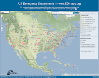
EDMap

Thursday, June 14, 2012
GeoPY and CSV file
Ok, yesterday evening and a bit today, I have updated my previous attempt to geocode a cvs table using GeoPy(http://code.google.com/p/geopy/). Here the code that I have wrote; it's not perfect but works. Next step will be adjust the output, and test it against a serious data-set.
Wednesday, March 21, 2012
Tuesday, September 20, 2011
Great app that involved Google Map API V3, Fusion Table and Google Visualization
http://cga-3.hmdc.harvard.edu/cluster/industry/

http://cga-3.hmdc.harvard.edu/cluster/industry/

Friday, September 9, 2011
Export to CAD from a DEM (ArcGIS/ArcInfo 10)
Export to CAD from a DEM (ArcGIS/ArcInfo 10)
1) Download the DEM and import it in ArcGIS
2) Convert the DEM to a contour file (isolines)
ArcToolBox >> Spatial Analysit >> Surface >> Contour
3) Create a 3D contour line
ArcToolBox >> 3D Analyst Tools >> 3D Features >> Feature To 3D By Attribute
4) Create a CAD .dwg file
ArcToolBox >> Conversion Tools >> To CAD >> Export to CAD
1) Download the DEM and import it in ArcGIS
2) Convert the DEM to a contour file (isolines)
ArcToolBox >> Spatial Analysit >> Surface >> Contour
3) Create a 3D contour line
ArcToolBox >> 3D Analyst Tools >> 3D Features >> Feature To 3D By Attribute
4) Create a CAD .dwg file
ArcToolBox >> Conversion Tools >> To CAD >> Export to CAD
Wednesday, May 25, 2011
Monday, May 2, 2011
Subscribe to:
Posts (Atom)