Sunday, November 7, 2010

Open Street Map Party at MIT


Hi there,

today I was at the OSM party at MIT (http://osmbos1.eventbrite.com/). It was pretty nice starting to edit OSM database,
and knowing better about this awesome project. I started to map features on my own
little mountain village, very fun seeing how the map change in few minutes....

Wednesday, October 6, 2010

Perform Cost Path Analysis between two points

Today I help a student to deal with Cost Path Analysis between two points. Below some tips:
  • Identify your study area (polygon layer) and use this one to cut your DEM by using Extraction by Mask function. Be sure you are working in a project coordinate system (slope requires it).
  • Use the new DEM to calculate the slope raster (Slope function)
  • Select only one of the two point (Point A)
  • Perform a Cost Distance; as input raster enter the point layer. Make sure you build also a Back Link raster.
  • Select the only the second point (Point B)
  • Perform a Cost Path; as input raster enter the point layer.

Tuesday, October 5, 2010

XML, XPath, XQuery Harvard Class

Just forgot to tell you that since the begging of September, I have started a Xml/XPath class
at Harvard Extension School. The class is pretty tough, but so far I really enjoy my self.
By the way, I have also stared to use Amazon EC2

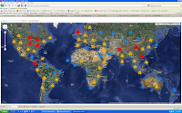
Google Cluster Mapping


In the last couple of moths, I have been working to implement
a google map mashup using clustering tech and the new v3 api. I decided to use php and postgis to store my dataset. finally jquery help me to implement link to map functionality.

Tuesday, March 30, 2010

Swiss Grid Projection


Today I have used a Swiss Grid Projection in ArcGIS to plot some data for a student.
I have got all the info from this nice site SWISSTOPO, and I ended up to have a very nice distorted map of the globe.

Wednesday, March 17, 2010

Python Max Value

I did it! I have just found a nice way to extract the maximum field value from a bench of records previously selected. The trick is to build up a Python list L = [], where
I can append all the selected items L.append =(row.fieldname). Next I can run max(L)
to extract the maximum value.

.....

Monday, March 1, 2010

The Greater Cairo


I have just made a quick map of the Greater Cairo...all data are coming from
Geocommunity (http://www.geocomm.com/).